
Blog
Land Development Costs in Lafayette, LA: What to Expect
Key Takeaways
- Land development cost in Lafayette, Louisiana is driven far more by site conditions — drainage, soils, elevation, and access — than by the acreage price itself.
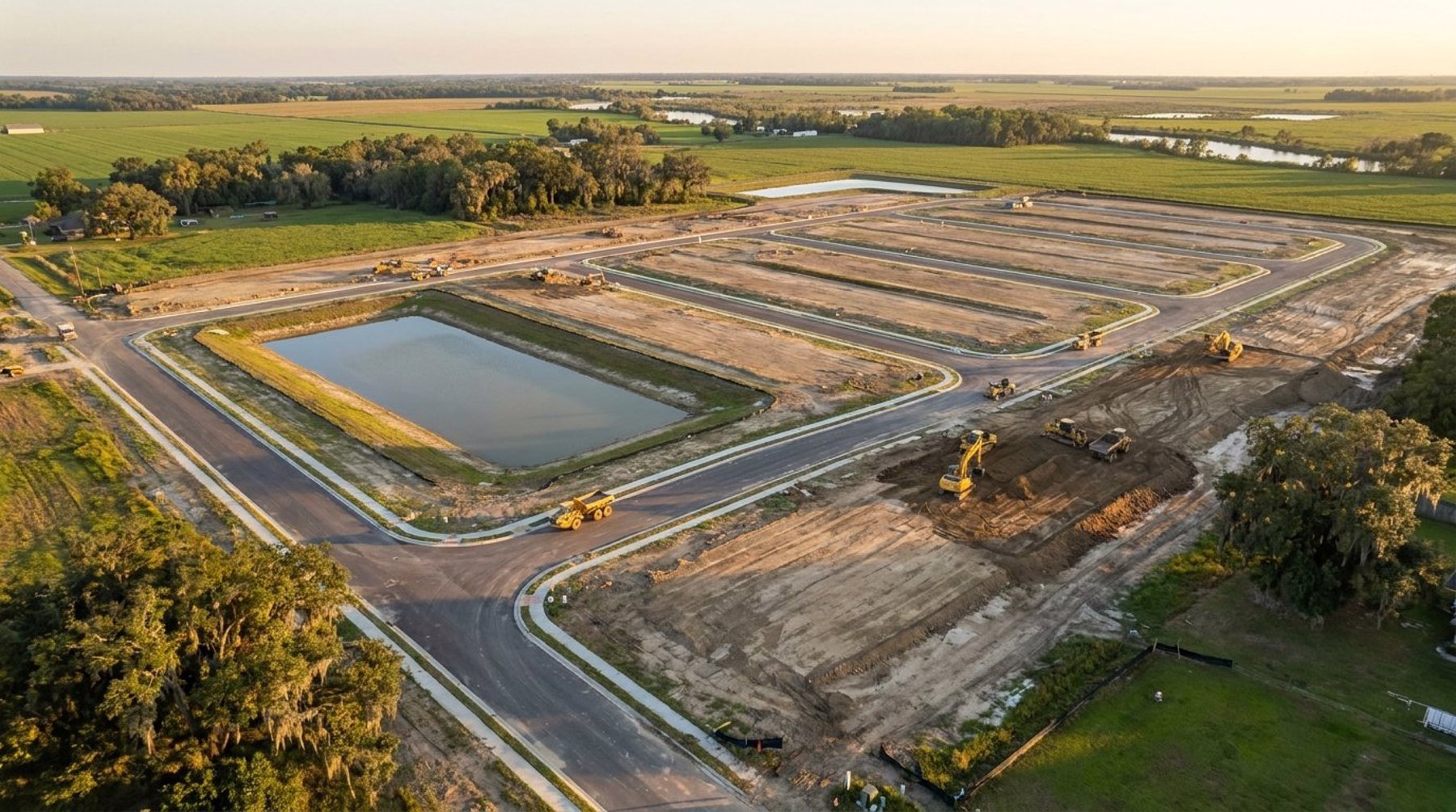
- Stormwater detention is usually the largest single cost variable on Acadiana sites, because flat terrain and high water tables force larger ponds and more earthwork.
- Due diligence work like a boundary and topographic survey, wetlands review, and a drainage feasibility check costs a fraction of a percent of the project, but it is what prevents six-figure surprises later.
- Any project disturbing one acre or more requires coverage under Louisiana's LPDES construction stormwater general permit and a SWPPP prepared before ground is broken.
What Drives Land Development Cost in Lafayette, Louisiana?
Land development cost in Lafayette, Louisiana is set by how much work a site needs before it can support buildings, pavement, and utilities. The purchase price is only the entry fee. Grading, stormwater detention, drainage improvements, utility extensions, streets, permitting, and engineering all follow, and on a difficult parcel those costs can exceed what the dirt cost to begin with.
Two parcels of identical size and asking price in Lafayette Parish routinely carry development budgets that differ by hundreds of thousands of dollars. The difference comes from physical facts: existing ground elevation relative to the floodplain, how far the nearest adequate outfall is, whether the site holds jurisdictional wetlands, how much fill is required, whether sewer is available or a lift station is needed, and what the reviewing agency will require for detention.
That is why experienced developers in Acadiana price a site by its engineering, not by its acreage. A civil engineering firm evaluates those constraints during due diligence so the number in the pro forma reflects the site that actually exists.
Due Diligence and Survey Costs Come First
Due diligence is the cheapest money spent in a land development budget. Before closing, most developers commission a boundary survey, a topographic survey, a preliminary wetlands and environmental review, a title review, and a drainage feasibility opinion. Together these typically represent a small fraction of total project cost, and they define every number that follows.
The topographic survey matters more in South Louisiana than almost anywhere else. Because the terrain across Lafayette, Broussard, and Youngsville is so flat, a difference of a foot or two in existing grade changes fill quantities, detention pond depth, and whether gravity drainage to an outfall is even possible. Survey accuracy is not a formality here — it is the input that controls the largest line items in the budget.
Environmental review deserves the same early attention. If a parcel contains wetlands subject to Clean Water Act jurisdiction, work affecting them requires a Section 404 permit from the U.S. Army Corps of Engineers, which administers Lafayette Parish through its New Orleans District. Individual permits can take many months and may require compensatory mitigation credits, which are a real and often substantial budget item. Finding that out before closing is a very different experience than finding it out after.
Drainage and Detention: The Biggest Cost Variable in Acadiana
Stormwater detention is usually the single largest cost driver on Lafayette-area development. New development increases impervious area, which increases runoff, and local drainage requirements generally obligate a project to detain that increase on site so downstream properties are not made worse off. That detention has to go somewhere, and the land it occupies is land that cannot be sold as lots or leased as building area.
The cost shows up twice. First as construction — excavation, hauling, pond slopes, outlet structures, and storm sewer. Second as lost yield, because a detention pond and its required buffers can consume a meaningful share of a site. On a tight commercial parcel, detention requirements are often what determines whether a proposed building footprint and parking count fit at all.
South Louisiana adds complications that inflate these numbers relative to other markets. Flat gradients mean long storm sewer runs to reach an outfall with adequate capacity. Shallow groundwater limits how deep a dry pond can practically go, pushing designs wider. And downstream systems in older areas may already be near capacity, which can require offsite improvements. A drainage impact analysis performed early quantifies these issues while the site plan can still be changed cheaply.
Permitting and Agency Review Costs in Lafayette Parish
Permitting costs are modest in dollars and expensive in time. Development in the city and parish is reviewed against Lafayette Consolidated Government's Unified Development Code, which governs zoning, setbacks, parking counts, landscaping, buffering, and the site plan approval that generally precedes a building permit. Municipalities such as Broussard, Youngsville, Scott, and Carencro maintain their own ordinances and review calendars, so the same project can follow different paths depending on where the line falls.
Several approvals commonly apply to a development project in the region:
- Site plan or subdivision plat approval from the governing municipality or parish, often with a preliminary and final stage.
- LPDES construction stormwater general permit from the Louisiana Department of Environmental Quality, required for construction disturbing one acre or more, supported by a SWPPP prepared before construction begins.
- Section 404 permitting from the U.S. Army Corps of Engineers where jurisdictional wetlands or waters are affected.
- Driveway or access permits from the Louisiana Department of Transportation and Development when a site connects to a state highway.
- Utility and servitude approvals from the applicable water, sewer, and electrical providers.
The schedule risk outweighs the fee schedule. Each review cycle that ends in a resubmittal adds weeks of carrying cost on the land, and on a leveraged deal that interest is a genuine development expense. Complete, coordinated submittals are one of the most reliable ways to protect a budget.
Earthwork, Utilities, and Infrastructure
Once approvals are in hand, the heavy costs are earthwork, drainage structures, utilities, and paving. Earthwork is the most controllable of the four. Fill dirt in South Louisiana has to be purchased and hauled when a site cannot balance internally, and haul distance often matters as much as material price.
Cut and fill analysis is how that cost gets managed. By modeling proposed grades against the surveyed existing surface, an engineer can test grading schemes and find the layout that moves the least material — frequently using soil excavated for the detention pond as fill for building pads and streets. Shifting a pond location or adjusting finished floor elevations by inches can change imported fill quantities substantially on a large site.
Utilities carry their own variability. A parcel adjacent to existing water and gravity sewer is inexpensive to serve. A parcel a quarter mile past the end of the line may require main extensions, bores under roadways, or a lift station with ongoing maintenance obligations. For residential work, streets, drainage, and utility infrastructure are typically the dominant line items in a subdivision design budget, which is why lot yield per developed acre governs the economics of the deal.
How Developers Control Land Development Costs
The most effective cost control happens before design is finished, when changes are still drawings rather than dirt. Developers who consistently hit budget in Lafayette Parish tend to do the same handful of things.
- Survey and study before closing. Use a due diligence period to confirm topography, drainage outfall, wetlands, flood zone, and utility availability.
- Test more than one layout. Comparing two or three concepts for earthwork balance and lot yield usually pays for the extra engineering many times over.
- Design detention as part of the site plan, not after it. Retrofitting a pond into a finished layout almost always costs yield.
- Confirm flood zone status early. FEMA flood zone designation affects finished floor elevations, fill volume, and flood insurance costs for the eventual owner, and a Letter of Map Amendment may be appropriate where mapping does not match actual ground elevation.
- Phase large projects. Building infrastructure in sections matches spending to absorption instead of financing the whole build-out up front.
Hensgens Trahan Engineering Consulting has carried projects across Acadiana from feasibility through construction staking, including developments such as Sugarmill Pond, Cedar Creek, and a range of commercial sites throughout Lafayette Parish. You can review representative work on the projects page.
If you are evaluating a parcel in Lafayette, Broussard, Youngsville, or anywhere in South Louisiana and want the development cost understood before you commit, contact HTEC or call (337) 443-0920 to talk through the site.
Frequently Asked Questions
How much does land development cost in Lafayette, Louisiana?
There is no single figure, because cost depends on site conditions rather than acreage. Drainage detention requirements, imported fill quantities, distance to usable utilities, wetlands presence, and flood zone status can cause two similar parcels in Lafayette Parish to carry development budgets that differ dramatically. A feasibility study that models grading, drainage, and layout is the only reliable way to get a number for a specific site.
What should I know before developing a piece of land in Acadiana?
Confirm five things before closing: the boundary and topography from a licensed survey, where stormwater can legally and physically discharge, whether jurisdictional wetlands are present, the FEMA flood zone designation, and whether water and sewer service can reach the site. Each of these can change a project's cost or feasibility, and all of them are far cheaper to investigate during a due diligence period than after purchase.
What is a feasibility study for land development?
A feasibility study is an engineering evaluation of whether a parcel can support an intended use and at what cost. It reviews zoning and the applicable development code, available utilities, drainage outfall and detention requirements, flood zone status, environmental constraints, and access, then tests a conceptual layout for yield. The result tells a developer whether the site works, what it will take, and where the budget risk sits.
Why is drainage such a large cost in South Louisiana development?
Flat terrain, shallow groundwater, heavy rainfall, and downstream systems that are often near capacity all work against easy drainage design. Developments are generally required to detain the increase in runoff they create, which means excavation, storm sewer, outlet structures, and land dedicated to a pond instead of to sellable lots or leasable building area. Those factors together make detention the largest cost variable on most Acadiana sites.
When is a SWPPP required in Louisiana?
A Storm Water Pollution Prevention Plan is required for construction activity disturbing one acre or more, including smaller sites that are part of a larger common plan of development. Coverage is obtained under the Louisiana Department of Environmental Quality's LPDES construction stormwater general permit, and the SWPPP must be prepared before ground is disturbed. It documents erosion and sediment controls, inspection procedures, and site-specific practices to keep sediment out of receiving waters.